


Maps are supposed to bring order to our world. We draw straight lines, color-code nations, and assume a boundary marks a clean, undisputed transition from one country to the next. But geography rarely cooperates with politics. Due to ancient treaties, colonial compromises, and shifting riverbeds, our planet is covered in geopolitical glitches. These bizarre border anomalies twist into puzzles, slicing through living rooms, leaving land completely unclaimed, or swapping nationalities entirely depending on the month.
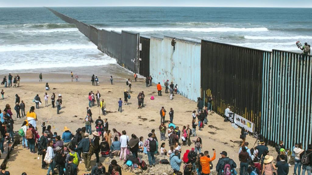
International boundaries look completely permanent when you scroll through an atlas or look at a globe. These lines divide our continents into neat, predictable territories that governments guard with passport checks and stone markers. For the most part, travelers believe that crossing a national line is a simple, straightforward process. We trust that a boundary sits exactly where the politicians agreed to put it.
Accordingly, this clean perspective completely falls apart when you look closely at the actual terrain. Throughout history, rulers and mapmakers made massive mistakes during late-night treaty sessions. They drew lines across unexplored wilderness using blunt pencils on low-resolution sketches. Sometimes, they relied on natural features like rivers and mountain ridges without realizing that nature constantly changes its shape.
These historical blunders created a world filled with strange territorial pockets that challenge our understanding of national sovereignty. These spots confuse local postal systems, trap citizens in legal vacuums, and force cities to run under two different sets of laws. Let us look at ten incredible examples that prove real human history refuses to live inside a flat grid.
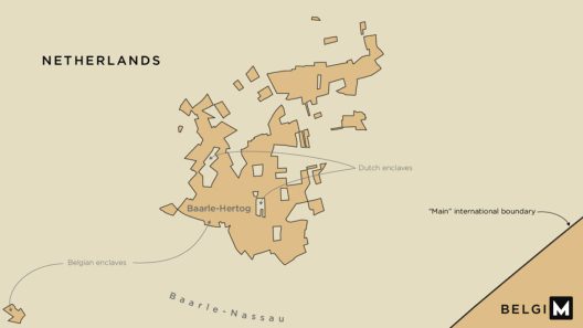
1. Baarle-Hertog and Baarle-Nassau (Belgium / Netherlands)
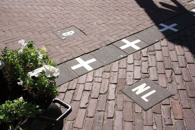
This region is a chaotic cluster of twenty-two Belgian enclaves inside the Netherlands, which also contain seven separate Dutch sub-enclaves. The international line slices directly through modern neighborhoods, cutting through local cafes, grocery store aisles, and backyard fences. To resolve the daily legal confusion, local laws say a resident’s nationality depends entirely on where their front door is. If the border splits your doorway, you legally live in both countries.
2. Bir Tawil (Egypt / Sudan)
Bir Tawil is an eight-hundred-square-mile desert territory legally classified as terra nullius, meaning it is land claimed by no country. This glitch stems from a major discrepancy between an 1899 political boundary line and a 1902 administrative line. Both Egypt and Sudan claim a different, nearby fertile zone called the Hala’ib Triangle. To claim that valuable triangle, both nations must legally renounce their claim to Bir Tawil, leaving this desert as one of the only habitable places on Earth that no recognized government wants.
3. Pheasant Island (Spain / France)
Sovereignty takes a creative turn on this tiny, uninhabited patch of trees sitting quietly in the middle of the Bidasoa River. Under the historic 1659 Treaty of the Pyrenees, Spain and France agreed to share the territory using a strict seasonal calendar. From February to July, the island officially belongs to Spain. Then, on the first day of August, control automatically flips over to France for the next six months, making it the oldest active condominium territory in existence.
4. The Diomede Islands (United States / Russia)
These two rocky islands are separated by just two and a half miles of cold ocean water, yet they sit in two completely different calendar days. Big Diomede belongs to Russia, and Little Diomede belongs to the United States, placing them in the middle of the Bering Strait. Because the International Date Line passes directly between them, Big Diomede sits twenty-one hours ahead of Little Diomede. This massive time gap earns them the famous nicknames “Tomorrow Island” and “Yesterday Island.”
5. Cooch Behar (India / Bangladesh – Historically)
Before a peaceful land-swap treaty resolved the gridlock in 2015, this region stood as the ultimate symbol of cartographic madness. It was home to the world’s only third-order enclave, featuring a piece of India inside a piece of Bangladesh, inside a piece of India, inside Bangladesh. For decades, thousands of residents lived in stateless legal vacuums because local police officers could not legally cross the overlapping national boundaries to assist them.
6. Jungholz (Austria / Germany)
Jungholz is a beautiful Austrian village that is surrounded by German territory, except for a single geographic connection point. The town attaches to the rest of Austria by a single, narrow mountain peak called the Sorgschrofen. Because high alpine ridges practically isolate the village from its own nation, the town uses German postal codes alongside Austrian ones. Historically, the community relied entirely on German infrastructure and emergency services to survive the winter.
7. The US-Canada Border Swaps (Point Roberts and Northwest Angle)
These unique locations are pockets of American land that citizens can access only by traveling through Canada or by taking a private boat across open water. When politicians established the 49th parallel as the international boundary line, they failed to realize it accidentally sliced off the tips of two isolated peninsulas. Today, residents of Point Roberts, Washington, must drive through Canada and pass through two international border checks to drop their kids off at an American high school.
8. Büsingen am Hochrhein (Germany / Switzerland)
This German town is completely marooned inside Swiss territory, creating a strange mix of cultural and political identities. Economically, the town functions entirely as a Swiss community by using the Swiss Franc, joining the Swiss customs area, and utilizing Swiss public services. Politically, however, the land remains German soil. This setup means residents vote in German elections but pay for their daily groceries under Swiss tax systems.
9. Derawan and Shifting River Borders
Many international lines follow the thalweg, the river’s deepest continuous channel. When major rivers flood or naturally shift their banks over several decades, large loops of farmland can overnight end up on the opposite side of the water channel. These natural movements prompt incredibly complex legal battles between local governments over who owns the new dry ground, proving that nature ignores human contracts.
10. Campione d’Italia (Italy / Switzerland)
This Italian town is completely separated from Italy by a deep lake and a massive Swiss mountain range. Located less than a mile from Italy as the crow flies, it is entirely encircled by the Swiss canton of Ticino. The enclave leans heavily on Swiss infrastructure for its telephone networks, license plates, and emergency services, despite its residents proudly flying the Italian flag outside their homes.
Overall, these geographical boundaries remind us that sovereignty is a living, breathing legal structure that constantly challenges our definition of space. Standard digital blueprints offer a helpful guide for daily navigation, but they cannot capture the quirks of human history. The world is much more than lines on a grid.
Which of these bizarre border anomalies would confuse you the most if you visited it today? Would you feel comfortable living in a house where your kitchen sat in a completely different country than your front door? Let us know your thoughts in the comments section below, and share this post with your fellow map lovers!