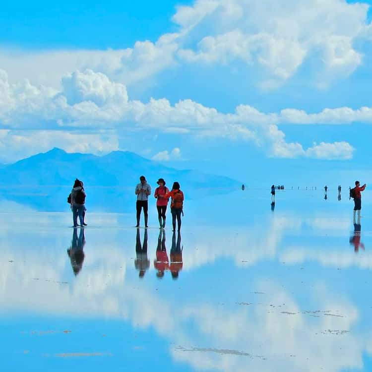


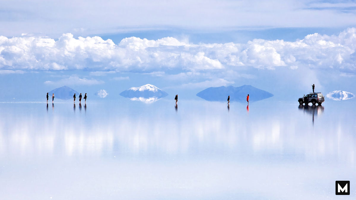
Standard topographical maps use textured brown ridges and green shading to separate high mountain peaks from low river valleys. We look at these standard markings to understand the basic physical boundaries of our continents. Yet, certain geographic landscapes throw out the traditional rules of altitude and texture entirely to create mind-bending optical illusions. High in southwest Bolivia lies Salar de Uyuni, a striking prehistoric basin that becomes the world’s largest mirror after a brief rainfall. This vast expanse of pure white salt covers more than ten thousand square kilometers, flattening the landscape so perfectly that the horizon vanishes into thin air.
This surreal salt desert sits thousands of meters above sea level on the windswept Andean Altiplano. Most natural landscapes feature rolling hills, deep ravines, and jagged rock formations sculpted by heavy erosion.
Essentially, Salar de Uyuni forms a completely level platform, with elevation across the entire ten thousand square kilometers varying by less than one meter. This extreme flatness dates back forty thousand years to the evaporation of massive prehistoric lakes. When those ancient inland seas dried up under the intense desert sun, they left behind a solid salt crust up to ten meters thick. For most of the year, this blinding white plain displays intricate hexagonal cracking patterns across the dry ground.
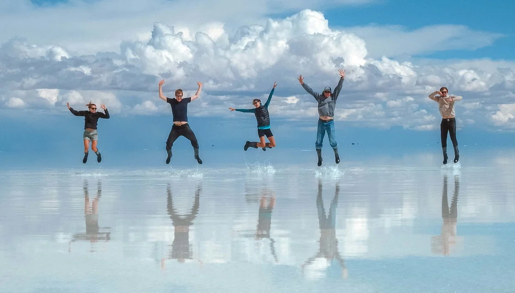
During the rainy season between December and April, this massive geometric plain changes its behavior completely. When shallow rainwater pools across the dense, non-porous salt crust, it creates a calm sheet of water just a few inches deep. With no natural slopes or drainage outlets, the water sits perfectly still, like a massive sheet of glass. This thin layer of calm liquid instantly reflects the bright blue sky, shifting clouds, and distant volcanoes. Travelers walking across the plain feel as if they are floating in space, suspended between matching halves of the sky.
As a result, this lack of terrain variation makes the landscape an invaluable tool for modern space exploration. International scientists routinely target this high-altitude white plain to calibrate the altimeters of Earth observation satellites. The brilliant white salt surface provides an incredibly stable, highly reflective target that lets orbiting radar systems verify their measurements with high precision. By comparison, standard land surfaces have too many trees, buildings, and shifting slopes to provide a reliable baseline. Space agencies like NASA use this ancient lake bed to fine-tune instruments that monitor global climate shifts and sea-level changes across our planet.
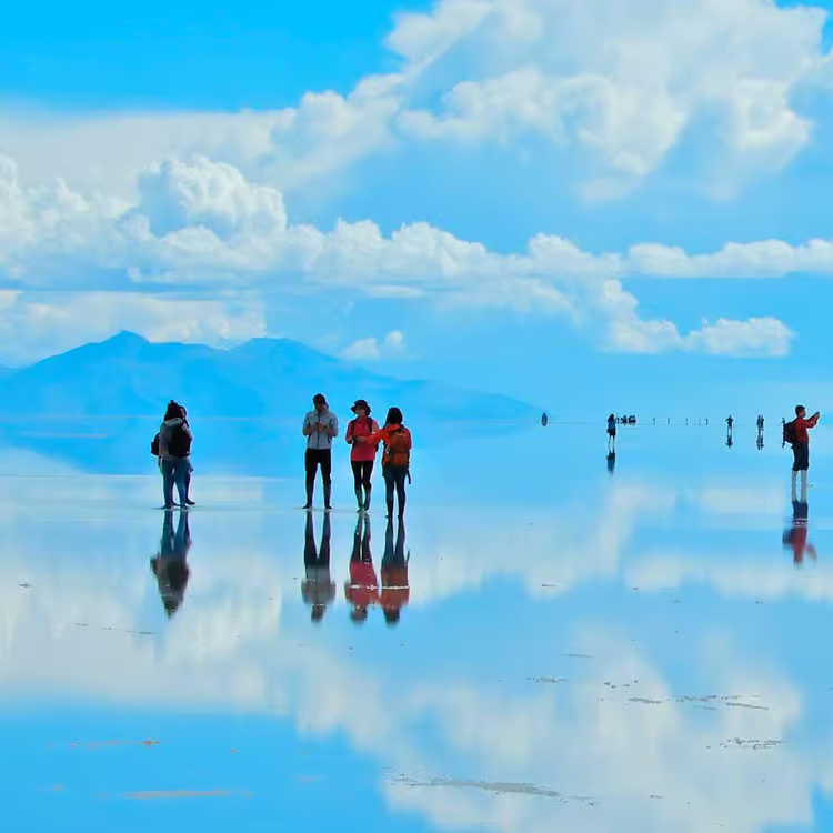
Overall, this magnificent Bolivian landscape proves that the physical earth can reshape our sense of reality without using artificial structures. While standard atlases list this region as a barren, high-altitude salt desert, the seasonal arrival of water reveals an enchanting visual masterpiece. It reminds us that geographic features can adapt, change, and turn a harsh wasteland into an infinite canvas of natural beauty. The world map is much more than lines on a grid.
Would you want to drive across this endless white horizon during the rainy season to see the sky’s reflection under your feet? Have you ever visited a geographic landmark that made you completely lose your sense of perspective or direction? Share your travel experiences in the comments below, and share this post with your fellow map lovers!